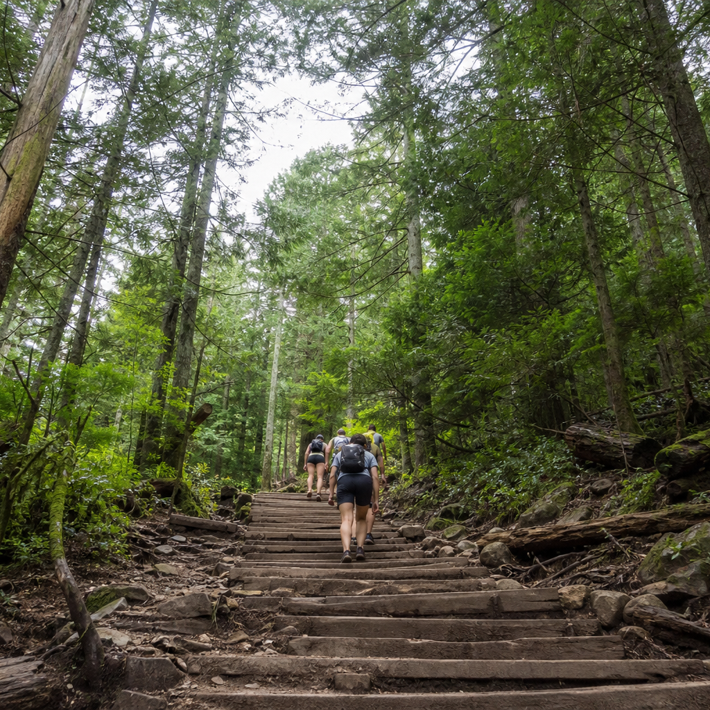
The Grouse
Grind
One-way up only: ~2.5 km and ~800 m gain with no flat sections—down-hiking the Grind is prohibited.
Duration
2–3 hours
Route distance
2.5km
Vertical Gain
+800m
Max Altitude
1,100m
Mission Brief
Vancouver’s “Mother Nature’s Stairmaster”: a 2.5 km one-way climb up the face of Grouse Mountain with roughly 800 m of gain, ~2,830 steps, and no flat recovery zones.
It is not a wilderness trek—it is an urban fitness ritual with full cell coverage, seasonal gates, and a mandatory gondola (or BCMC) descent because down-hiking the Grind is prohibited.
Sources
A steep, stair-heavy workout minutes from downtown—city views at the top without a multi-day commitment or alpine remoteness.
Mission Snapshot
Intensity Breakdown
Understanding what drives the overall route demand
Physical
42
Technical
12
Commitment
6
Primary driver: ~320 m/km sustained stair climb in under three hours
- Extreme vertical density on a short one-way ascent
- Sustained stair climbing with no flat recovery
- Wet wood, mud, and crowded narrow steps (Class 1, not scrambling)
- Seasonal gates and mandatory alternate descent logistics
Active effort required, but no significant risk. Suitable for recreational hikers.
Full Route Breakdown
Complete stage overview with transparent route metrics. Values are shown as recorded in the route dataset and source links.
Distance
2.5 km
Ascent
800 m
Highest point
1,100 m
Start
Grouse Mountain trail gate (near Skyride base)
Finish
Grouse Mountain Peak / Peak Chalet plateau
Use the KM / MI toggle in the main menu to switch units.
Operational Reality
Modeled on the official one-way ascent (Grouse Mountain + Metro Vancouver): 2.5 km, 300–1,100 m, ~800 m gain. Quarter markers are psychological checkpoints, not survey-grade GPS. Descent is not on the Grind—Skyride or BCMC only.
Route Considerations
High physical demand on knees and cardio for the grade; low altitude and strong cell coverage. Seasonal closure for ice and rockfall; summit weather can be much colder than the base parking lot.
Physical strain
Extremely steep sustained climbing; knee and ankle strain are common on the stairs.
Impact
Route-specific
Likelihood
Context-dependent
Tip
Supportive footwear, pacing, hydration; avoid if you have unmanaged heart or breathing conditions—Metro Vancouver explicitly warns high blood pressure, heart, or asthma sufferers.
Weather and seasonal closure
Summit can be ~10°C cooler than the base; ice, snow, and rockfall close the trail in winter and after storms.
Impact
Route-specific
Likelihood
Context-dependent
Tip
Check Metro Vancouver and Grouse Mountain conditions; carry a layer and headlamp; do not start late—gates lock to prevent night rescues.
Crowding and one-way rules
Narrow stair sections with heavy two-way conflict if rules are ignored; downhill hiking is banned.
Impact
Route-specific
Likelihood
Context-dependent
Tip
Respect one-way rules; use BCMC for a quieter parallel route when the Grind is packed or closed.
Why hike this route?
LANDSCAPE
Harbour and city panorama from the Peak Chalet plateau.
VARIETY
Quarter markers as psychological checkpoints through coastal rainforest.
CULTURE & PLACE
Shared suffering with hundreds of locals chasing personal best times.
WHY GO
A steep, stair-heavy workout minutes from downtown—city views at the top without a multi-day commitment or alpine remoteness.
Expert Verdict
“A Vancouver rite of passage: more mountain gym than backcountry hike. Respect one-way rules, seasonal gates, and the Skyride budget. If the stairs are packed, BCMC is the locals’ pressure valve.”
Who This Is For
- INTERMEDIATE — Fit hikers and runners who accept sustained uphill cardio—not a casual park walk.
- PHYSICAL — High for the distance: ~800 m in 2.5 km. Expect elevated heart rate the entire climb and sore quads after the gondola ride down.
- WATCH FOR — Attempting to hike down the Grind—prohibited and dangerous for others on the stairs.
- WATCH FOR — Starting without water or a Skyride/download plan.
Compare This Route
See how this route compares to similar hikes in overall demand and terrain profile.Compare routes by the shape of the effort, not only the headline score.
Sulphur Skyline
Closest overall match in demand profile
The hike to the summit of Sulphur Skyline is a pure test of steady cardiova...
Intensity
Slightly lower intensityIsla del Sol
Lower overall intensity, similar terrain type
The primary trekking route on Isla del Sol is the 'Ridge Path'—an ancient t...
Intensity
Lower intensitySaxer Lücke
Higher physical or technical demand
The Saxer Lücke is one of the most geographically dramatic points in the Al...
Intensity
Higher intensityExplore Alternatives
Broaden the picture with easier, harder, and nearby options.
Looking for something easier?
Lower intensity — helpful if this route feels like a stretch right now.
Dachstein Krippenstein — The 5 Fingers & Alpine Shark
Salzkammergut, Obertraun/Hallstatt · austria
Distance
6.5 km
Ascent
200 m
The Gaisalmsteig — Achensee’s Fjordside Path
Karwendel, Tyrol · austria
Distance
8.6 km
Ascent
250 m
Grossglockner — The Gamsgrubenweg Trail
Hohe Tauern, Carinthia/Salzburg · austria
Distance
8.2 km
Ascent
220 m
Want more challenge?
Higher intensity — for when you are ready for a bigger physical or technical step.
More hikes in this region
Nearby and regionally relevant routes for the next step in your search.
Berg Lake Trail
british-columbia · canada
Distance
42.0 km
Ascent
800 m
Lake Agnes Tea House
lake-louise-banff-national-park-alberta · canada
Distance
7.4 km
Ascent
400 m
Panorama Ridge
garibaldi-provincial-park-british-columbia · canada
Distance
30.0 km
Ascent
1,520 m
Skyline Trail
alberta · canada
Distance
44.1 km
Ascent
1,400 m
Slim’s River West Trail
kluane-national-park-yukon · canada
Distance
45.0 km
Ascent
1,400 m
The East Coast Trail
newfoundland · canada
Distance
336.0 km
Ascent
—
Compare with any route
Pick any hike worldwide and open a full side-by-side comparison.
What You Need to Know
Essential answers about the demands, risks, and logistics of this route.
Q.How hard is this hike really?
Q.Do I need technical gear?
Q.Is water available on the route?
Q.What is the main risk?
Ready to hike The Grouse Grind?
A final decision point after reviewing the route, risks, logistics, and alternatives.
This route is a strong match if you're comfortable with the effort level implied by an Intensity Score around 37/100 (Moderate), sustained hiking where this route requires it, and the terrain and exposure described in this guide.
Looking for something easier, more challenging, or a different terrain profile?
Compare routes by intensity, terrain, and region.