Volcán
Barú
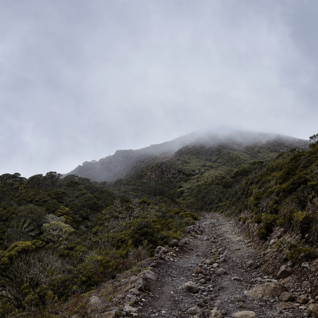
Night push from Boquete; the 'easy road' lie ends at the first steep kilometre.
Classification
Severe
Duration
1 day
Route distance
27.0km
Vertical Gain
+1,700m
Max Altitude
3,474m
Mission Brief
Volcán Barú is Panama's highest summit (3,474 m): a brutal night hike from Boquete up a loose volcanic 4×4 road—27 km round-trip for a sunrise that can reveal both the Pacific and Caribbean on the clearest mornings.
It is not a technical climb; it is a clock-and-cold endurance test (sleep debt, thin air, and a long descent on cobblestone-like rubble).
No water on the 27 km loop—carry 3 L minimum; dehydration risk rises sharply above km 9 with no reliable refill.
Mission Snapshot
Intensity Breakdown
Understanding what drives the overall route demand
Physical
81
Technical
50
Commitment
55
Primary driver: Peak single-day physical spike
- 27 km round-trip with +1,700 m in one night-to-sunrise push
- Summit cold, wind, and sleep debt at 3,474 m
- No water on route—dehydration risk increases sharply above km 9 with no refill
- Long loose-cobble descent after the summit wait
This score reflects peak single-day intensity, not expedition commitment. Volcán Barú is less remote than multi-day wilderness routes, but its one-night push (27 km, +1,700 m, cold ridge wait, no water) is severe. The Severe band here means one-day vertical load, night pacing, summit cold, and a long descent—not expedition remoteness.
Full Route Breakdown
Complete stage overview with transparent route metrics. Values are shown as recorded in the route dataset and source links.
Distance
27.0 km
Ascent
1,700 m
Highest point
3,474 m
Start
Boquete park entrance (4×4 road)
Finish
Boquete park entrance
Use the KM / MI toggle in the main menu to switch units.
Route Profile
Single-night summit push structure
⚠ One-way distance is 13.5 km on the Boquete 4×4 road (~27 km round-trip). Elevation gain is about 1,700 m (Wikivoyage / Wikitravel). Summit elevation 3,474 m (Visit Panama / MiAmbiente).
Operational Reality
La Soledad out-and-back from Antigua—~16 km round trip. Confirm stage distances with your operator; not the Boquete road (Panama).
Route Considerations
High endurance and cold exposure: mild Boquete warmth can drop to near-freezing wind on the summit. No water on the 13.5 km road, intermittent to absent cell coverage (do not rely on signal), and a long descent on loose volcanic cobbles after sunrise.
Nighttime hypothermia
The hike starts at 20°C but the summit can drop to 0°C (32°F) with high winds.
Impact
Route-specific
Likelihood
Context-dependent
Tip
Pack thermal layers, a down jacket, and a beanie; do not underestimate the cold even in the tropics.
Physical exhaustion
Walking 13.5 km uphill in darkness on a rocky 4×4 road is mentally and physically draining.
Impact
Route-specific
Likelihood
Context-dependent
Tip
Start at 11:30 PM to allow 6-7 hours for the ascent; carry high-energy food (nuts/chocolate); use trekking poles to save your knees on the descent.
Terrain & conditions
Conditions change quickly on the ground. Slow down on wet rock and pay more attention where paths narrow or exposure increases.
Impact
Moderate
Likelihood
Variable
Tip
Refer to stage notes and expert briefings; maintain focus on slick or exposed sections.
Why hike this route?
LANDSCAPE
The surreal experience of watching two different oceans emerge from the darkness as the sun rises.
VARIETY
The transition from the lush, noisy cloud forest at the base to the silent, frozen volcanic tundra at the peak.
CULTURE & PLACE
A shared sense of camaraderie with other 'night hikers' you pass along the trail—everyone is suffering and striving for the same view.
STANDOUT
Standing on the narrow rocky ridge at the true summit cross, with the world falling away into two different seas—that is the X-factor on a clear morning.
Expert Verdict
“Volcán Barú rewards disciplined night pacing more than technical skill. Start around 11:30 PM–midnight so you are not waiting hours in dangerous cold exposure before sunrise. Carry a dry base layer for the ridge, 3 L of water, and trekking poles for the long descent on loose stone. Past the antenna field, the short scramble to the cross is where the best views are on clear mornings.”
Who This Is For
- EXPERT (PHYSICAL ENDURANCE) — Fit hikers only: comfortable with 6–8 hours uphill in oxygen-thin night air, significant sleep deprivation, and layers for near-freezing windchill at 3,474 m. Not a technical climb—pacing, cold management, and water discipline matter more than rope skills.
- PHYSICAL — Extremely high: ~1,700 m gain in one push on 13.5 km of loose volcanic cobbles. The road looks easy on paper; the friction, altitude, and descent punishment are not.
- WATCH FOR — Bringing only a light hoodie; the wind chill at 3,400m is strenuous—you need a down jacket and a windbreaker.
- WATCH FOR — Underestimating the descent; many people burn all their energy on the way up and realize the 13.5 km downhill on loose cobbles is just as punishing on the joints.
Plan This Hike
Key things to arrange before starting this route—practical tips first, then buttons that open curated picks (gear, maps, stays) where we list them.
Essential Gear
Recommended preparation for this route:
Night summit push on a rocky road—cold ridge wind and zero resupply on the 27 km loop.
- Headlamp with spare batteries; down jacket and wind shell (summit wait is cold—even in Panama)
- 3 L water minimum—no refill on the 27 km road; high-energy food for 9–13 hours
- Trekking poles and sturdy boots for the long descent on loose volcanic cobbles
Stay Connected
Explore accommodation options for this trail:
Intermittent to absent coverage on the upper mountain—do not rely on signal for safety.
- Download offline maps before leaving Boquete
- Share your start time and expected return with your hotel or driver
- Patchy signal may exist near summit antennas—treat phones as backup only
Getting There
Travel and trail access for this route:
Base in Boquete; taxis reach the park entrance in about 15 minutes.
- Register with MiAmbiente when rules require it (often 24 hours ahead)
- Arrange a taxi for ~11:30 PM departure and a morning pickup
- Carry cash for park fees; ranger checks can occur on descent
Where to Stay
Explore accommodation options for this trail:
Sleep in Boquete the night before—no camping on the exposed summit.
- Book lodging in town for a pre-dawn start
- Dry base layer for the summit wait after the sweaty climb
- Rest before the descent; the downhill is hard on knees
Compare This Route
See how this route compares to similar hikes in overall demand and terrain profile.Compare routes by the shape of the effort, not only the headline score.
Kandersteg to Adelboden via Bunderchrinde
Closest overall match in demand profile
Stage 13 of the Via Alpina (Swiss Path) is characterized by a strenuous but...
Intensity
Lower intensityAlpine Pass Route
Lower overall intensity, similar terrain type
The Alpine Pass Route (National Route 1) is a classic trans-Swiss trek that...
Intensity
Lower intensityCordillera Real Traverse
Higher physical or technical demand
The Cordillera Real Traverse is considered by many high-altitude trekkers t...
Intensity
Higher intensityExplore Alternatives
Broaden the picture with easier, harder, and nearby options.
Looking for something easier?
Lower intensity — helpful if this route feels like a stretch right now.
Want more challenge?
Higher intensity — for when you are ready for a bigger physical or technical step.
More hikes in this region
Nearby and regionally relevant routes for the next step in your search.
Compare with any route
Pick any hike worldwide and open a full side-by-side comparison.
What You Need to Know
Essential answers about the demands, risks, and logistics of this route.
Q.How hard is this hike really?
Q.Do I need technical gear?
Q.Is water available on the route?
Q.What is the main risk?
Ready to hike Volcán Barú?
A final decision point after reviewing the route, risks, logistics, and alternatives.
This route is a strong match if you're comfortable with the effort level implied by an Intensity Score around 83/100 (Severe), sustained hiking where this route requires it, and the terrain and exposure described in this guide.
Build your itinerary, stages, and logistics.
Looking for something easier, more challenging, or a different terrain profile?
Compare routes by intensity, terrain, and region.