Alpe Adria
Trail
43 official stages over circa 750 km, including the optional three-country circular tour.
Duration
43 days
Route distance
750.0km
Vertical Gain
+24,800m
Max Altitude
2,370m
Mission Brief
The Alpe Adria Trail is a long-distance hiking route from Kaiser-Franz-Josefs-Höhe in Austria to the Adriatic port of Muggia in Italy. It records 43 official stages over circa 750 km, including the optional three-country circular tour; the linear traverse from Kaiser-Franz-Josefs-Höhe to Muggia counts 37 stages.
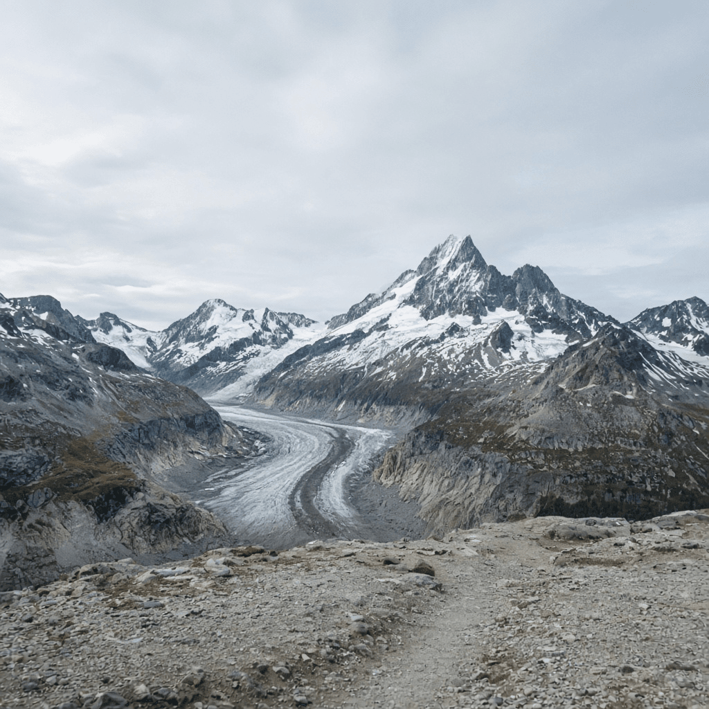
The start sits at the foot of the Grossglockner (3,798 m). That summit is not on the trail. The trail high point is 2,370 m at Kaiser-Franz-Josefs-Höhe (GROHAG 2,369 m). From there the marked stages run through Hohe Tauern National Park, the Nock Mountains, the Julian Alps, the Soča Valley, and the karst of Friuli-Venezia Giulia to the sea.
Official publications (alpe-adria-trail.com and austria.info) give about 750 km and about six hours per stage. Typical walking time is 5–7 hours a day across 43 stages. Cumulative gain is 24,800 m and loss 26,900 m. The trail is a discovery route: marked stages, huts and guesthouses, no via ferrata required and no glacier crossing on the walking line. It is standard alpine hiking, not a mountaineering traverse of the Grossglockner.
Stage 1 begins at Kaiser-Franz-Josefs-Höhe beside the Pasterze glacier viewpoint and descends toward Heiligenblut. Mid-trail stages follow the Soča toward Bovec after the Vršič Pass. The last official stage reaches Muggia via the Rilke Trail above the Gulf of Trieste. Luggage transfer and a booking centre exist; hut beds in July and August need advance booking.
Sources
43 official stages / circa 750 km from Kaiser-Franz-Josefs-Höhe to Muggia, including the optional three-country circular tour; 37 stages if you walk only the linear traverse.
Mission Snapshot
Intensity Breakdown
Understanding what drives the overall route demand
Physical
72
Technical
22
Commitment
78
Primary driver: Endurance and logistics across 43 official stages, not technical alpine climbing
- 43 official stages / 750 km including the circular tour
- 24,800 m gain on hiking paths
- Hohe Tauern weather in the first quarter
- Three-country hut booking, not wilderness isolation
Advanced multi-day effort: heavy fatigue, logistics, or movement friction—not necessarily alpine exposure.
Full Route Breakdown
Complete stage overview with transparent route metrics. Values are shown as recorded in the route dataset and source links.
Distance
750.0 km
Ascent
24,800 m
Highest point
2,370 m
Start
Kaiser-Franz-Josefs-Höhe, Hohe Tauern, Austria
Finish
Muggia, Italy
Use the KM / MI toggle in the main menu to switch units.
Operational Reality
The three itinerary blocks are waypoints, not a 750 km stage list; stage kilometres are omitted so they cannot be summed against the headline. Headline distance 750 km and 43 stages are the official 43-stage publication including the optional three-country circular tour. The linear Kaiser-Franz-Josefs-Höhe → Muggia traverse is 37 stages. Elevations: high 2,370 m, low 0 m, gain 24,800 m, loss 26,900 m. Sources: alpe-adria-trail.com, austria.info, GROHAG KFJ-Höhe 2,369 m.
Route Considerations
This route is generally safe, but these are the main factors to be aware of.
Weather volatility in high stages
Stages 1–10 sit in the Hohe Tauern, where storms and unseasonal snow can arrive in summer.
Impact
Route-specific
Likelihood
Context-dependent
Tip
Check ZAMG mountain forecasts daily. Keep insulating layers through the first two weeks. High alpine stages are typically open late June to early October.
Navigation through karst terrain
Slovenian and Italian karst stages run on sharp limestone with limited surface water.
Impact
Route-specific
Likelihood
Context-dependent
Tip
Carry extra water on the lower coastal stages. Use the official Alpe Adria Trail app for waypoints. The walking line is marked; it is not a glacier or ferrata line.
Terrain & conditions
Conditions change quickly on the ground. Slow down on wet rock and pay more attention where paths narrow or exposure increases.
Impact
Moderate
Likelihood
Variable
Tip
Refer to stage notes and expert briefings; maintain focus on slick or exposed sections.
Why hike this route?
LANDSCAPE
Kaiser-Franz-Josefs-Höhe under the Grossglockner at the start; Muggia and the Adriatic at the finish.
VARIETY
Hohe Tauern, Nock Mountains, Julian Alps, Soča, karst, coast — 43 official stages or 37 linear.
CULTURE & PLACE
Germanic, Slavic, and Romance overnight stops on one marked trail (Austria, Slovenia, Italy).
WHY GO
43 official stages / circa 750 km from Kaiser-Franz-Josefs-Höhe to Muggia, including the optional three-country circular tour; 37 stages if you walk only the linear traverse.
Expert Verdict
“The Alpe Adria Trail is a marked discovery trek, not a climb of the Grossglockner. The published whole is 43 official stages and circa 750 km, including the optional three-country circular tour. The linear Kaiser-Franz-Josefs-Höhe → Muggia traverse is 37 stages, not 750 km. Gain 24,800 m, loss 26,900 m, high 2,370 m, walking 5–7 hours a day. No via ferrata or glacier travel. Book huts; carry water on karst stages; treat the first Hohe Tauern week as the weather crux.”
Who This Is For
- INTERMEDIATE — Multi-day trekking fitness for 5–7 hours a day across several weeks, and the habit of booking huts. No via ferrata or glacier travel is required.
- PHYSICAL — High because of duration: 43 official stages, 750 km, 24,800 m of gain. Individual days are hiking-path days, not a technical alpine climb.
- WATCH FOR — Equating 37 linear stages with 750 km. Who says 37 must not keep 750 without the circular tour.
- WATCH FOR — Starting too fast in the Hohe Tauern (stages 1–10).
Plan This Hike
Key things to arrange before starting this route—practical tips first, then buttons that open curated picks (gear, maps, stays) where we list them.
Essential Gear
Recommended preparation for this route:
Hut-to-hut boots and a shell — 43 official stages, not a ferrata rack.
- Durable trekking boots for alpine paths and karst
- Rain shell for Hohe Tauern and Soča afternoon cells
- No via ferrata kit
Stay Connected
Explore accommodation options for this trail:
Use the official trail app for waypoints; coverage is good, not guaranteed on every ridge.
- Official app for stage waypoints
- Extra water on Italian karst stages
- ZAMG mountain forecasts for stages 1–10
Getting There
Travel and trail access for this route:
Start at Kaiser-Franz-Josefs-Höhe; finish in Muggia near Trieste.
- Seasonal bus from Lienz or Winklern to the start terrace
- Finish at Muggia; TRS is the nearest airport
- 43 official stages include the circular tour; 37 is the linear traverse
Where to Stay
Explore accommodation options for this trail:
Huts and guesthouses at stage ends; book July–August early.
- Hut-to-hut is the designed model; no tent required
- Booking centre and luggage transfer exist
- Grossglockner-area and Julian Alps beds fill months ahead
Compare This Route
See how this route compares to similar hikes in overall demand and terrain profile.Compare routes by the shape of the effort, not only the headline score.
Alta Via 1
Closest overall match in demand profile
The Alta Via 1 is the mainstream Dolomites hut traverse: ~120 km from Lago ...
Intensity
Higher intensityHuayna Potosi
Lower overall intensity, similar terrain type
Huayna Potosi (6,088m / 19,974ft) is often described by Bolivian guide serv...
Intensity
Lower intensityCondoriri Trek
Higher physical or technical demand
Shadowing the immense peaks of the Cordillera Real north of La Paz, the Con...
Intensity
Higher intensityExplore Alternatives
Broaden the picture with easier, harder, and nearby options.
Looking for something easier?
Lower intensity — helpful if this route feels like a stretch right now.
Want more challenge?
Higher intensity — for when you are ready for a bigger physical or technical step.
Victoria Peak Trail
Cockscomb Basin Wildlife Sanctuary, Stann Creek District · belize
Distance
27.0 km
Ascent
950 m
Long Range Traverse
gros-morne-national-park-newfoundland · canada
Distance
35.0 km
Ascent
700 m
Alpine Pass Route
Bernese Oberland / Glarus Alps / Valais · switzerland
Distance
390.0 km
Ascent
24,000 m
More hikes in this region
Nearby and regionally relevant routes for the next step in your search.
Compare with any route
Pick any hike worldwide and open a full side-by-side comparison.
What You Need to Know
Essential answers about the demands, risks, and logistics of this route.
Q.How hard is this hike really?
Q.Do I need technical gear?
Q.Is water available on the route?
Q.What is the main risk?
Ready to hike Alpe Adria Trail?
A final decision point after reviewing the route, risks, logistics, and alternatives.
This route is a strong match if you're comfortable with the effort level implied by an Intensity Score around 68/100 (Very Hard), sustained hiking where this route requires it, and the terrain and exposure described in this guide.
Build your itinerary, stages, and logistics.
Looking for something easier, more challenging, or a different terrain profile?
Compare routes by intensity, terrain, and region.